
| LAS PIÑAS-PARAÑAQUE WETLAND PARK |
|---|
| LAS PIÑAS-PARAÑAQUE WETLAND PARK |
|---|
| Forest Formation | |
|---|---|
| Legend | Area(has.) |
| Vegetative Cover | |
|---|---|
| Legend | Area(has.) |
| Natural Wetland |
|---|
| Human-made Wetland |
|---|
| Caves | ||||
|---|---|---|---|---|
| Cave Name | Area (has.) | Location | Cave Classification | Status |
| Elevation | |
|---|---|
| Highest Elevation (meters): 7.00 | Lowest Elevation (meters): 0.00 |
LPPWP Slope description is based on the readily available data from geoportal.gov.ph website.
Based on the data published by the Bureau of Soils and Water Management (BSWM) of Department of Agriculture last 2013, LPPWP has portion of it with Fine Sandy Loam type of soil.

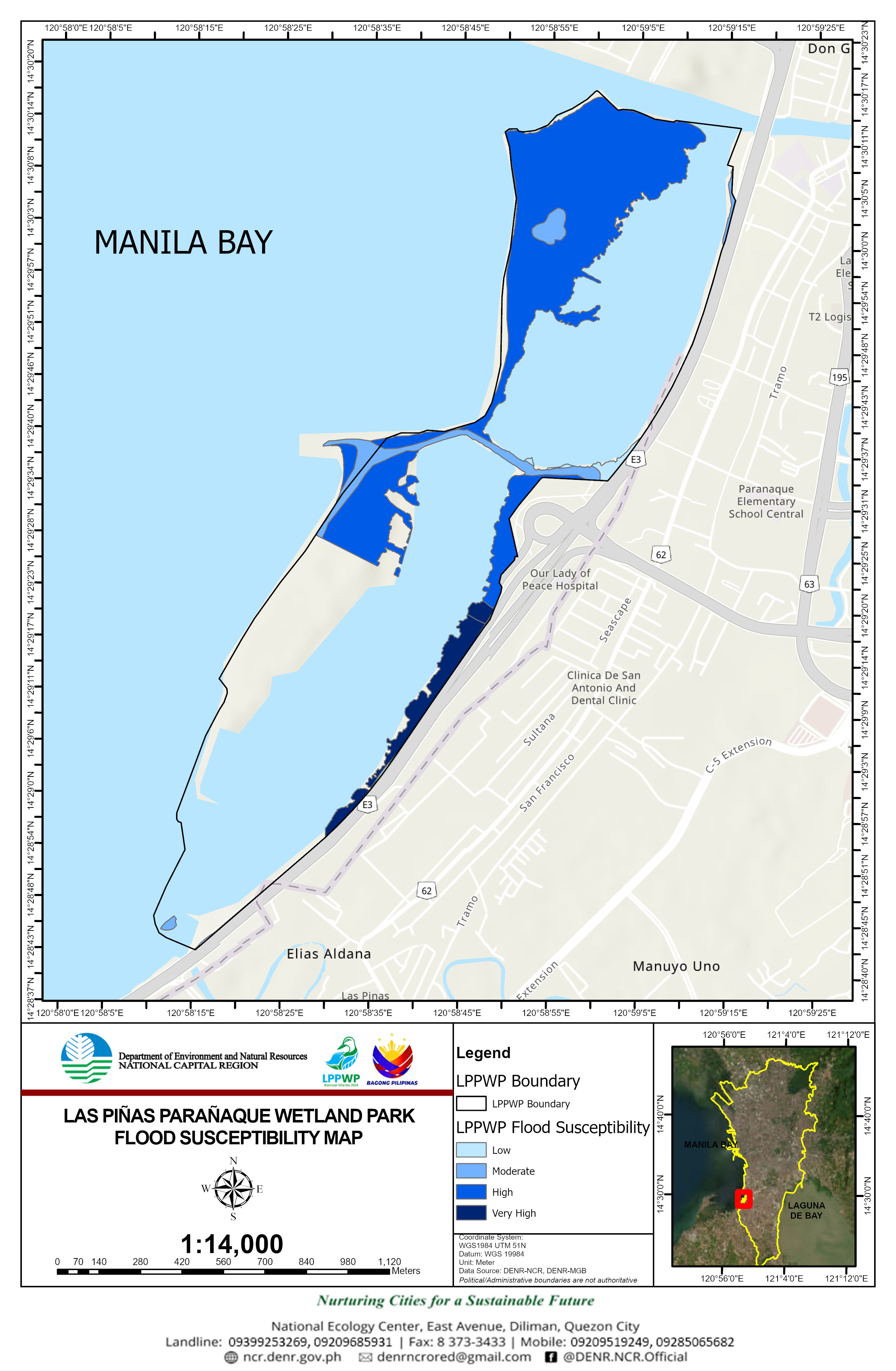
Very High - 6.700
Moderate - 4.800
High - 39.430
Low - 0.770
| Sector | Program and durations | Details | Proponent/Implementing Partner | Projects/Researches |
|---|
| Sector | Project Name | Proponent | Duration | Source of Fund | Area(has) | Location |
|---|
| Type | Purpose |
|---|
.jpg)
| Inventory of Existing Infrastructure | |||||||||
|---|---|---|---|---|---|---|---|---|---|
| Types of Facility/Structures/Infrastructures | Unit (no.) | Date Established | Management Zone (SPZ/MUZ) | Within Easement Zone | Status | Affected by recent Typhoon | Tenurial Instrument/Certification Issued | Appropriate Recommendations | Remarks |
| event |
|---|